Battlefield Management System (BMS)
 Satellite
 Map
Map
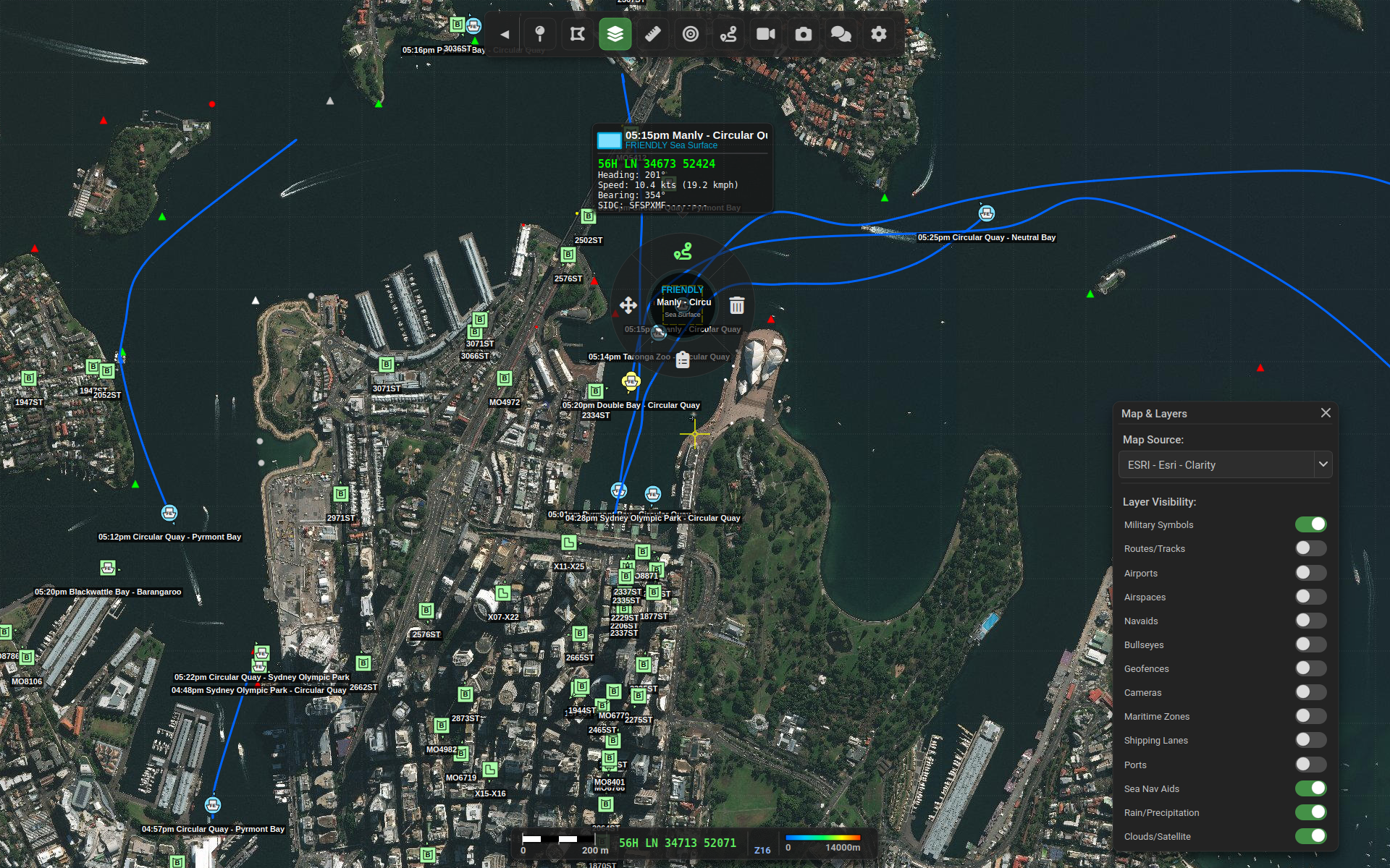
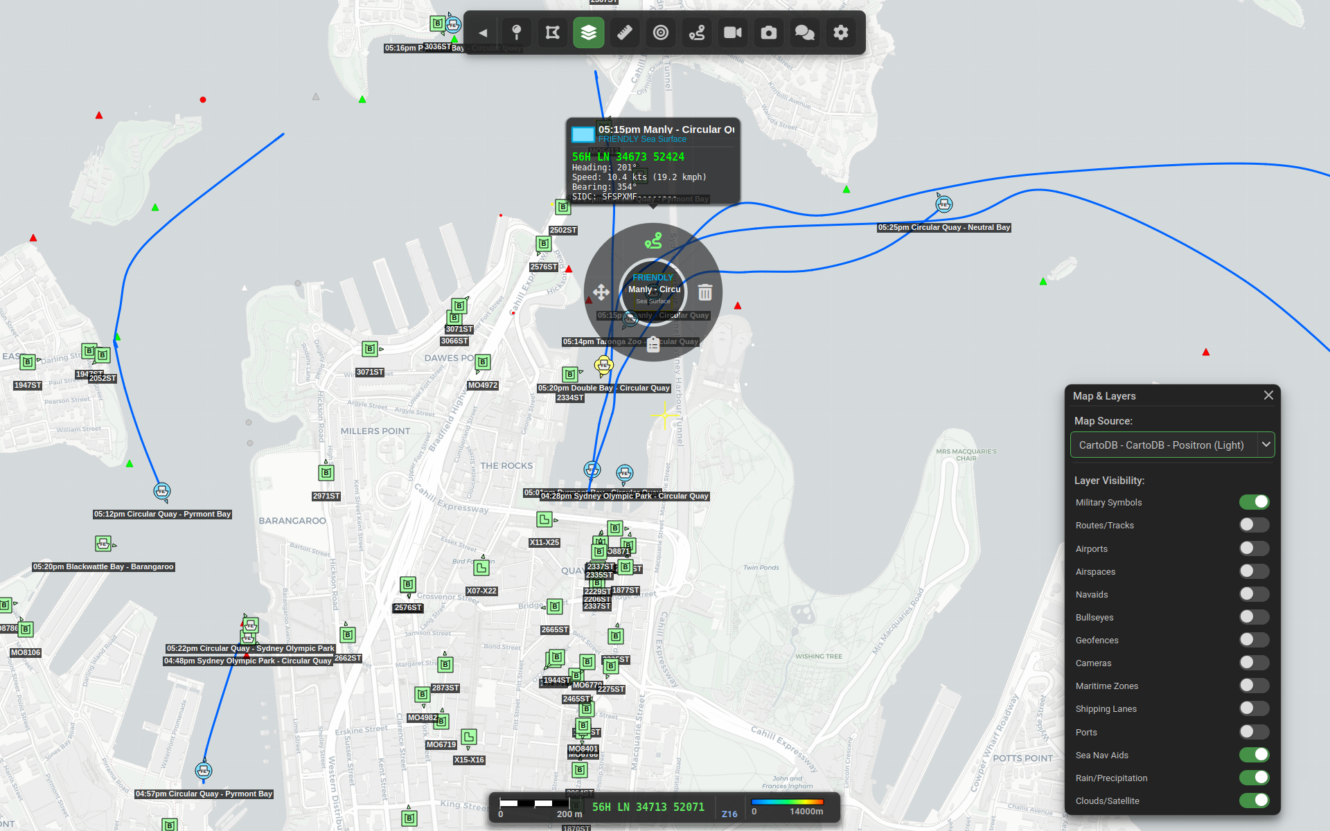
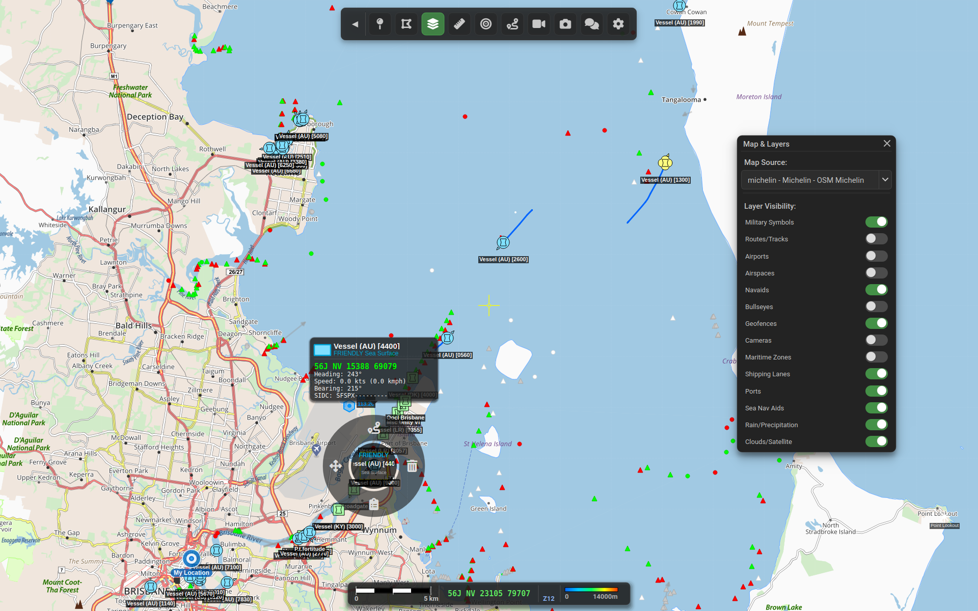
Mission-Ready Situational Awareness
Astute Systems' Battle Management System delivers real-time tactical situational awareness engineered for the modern battlefield. Built from the ground up with interoperability and performance at its core, our BMS empowers commanders and soldiers with the information they need, when they need it.
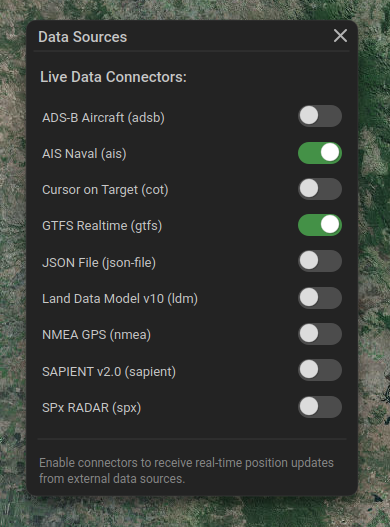
Bring your own transponder reciever or connect to online data sources.
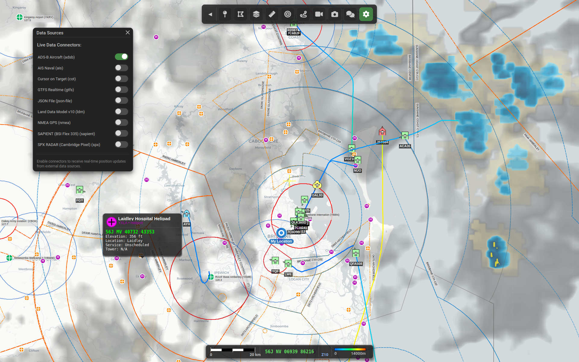
Bring your own transponder reciever or connect to online data sources.
Use Google GTFS protocol to view open source data for bus, trians, light rail, trams and ferries.
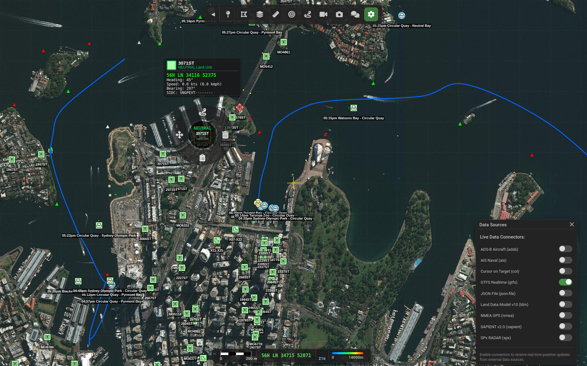
Connectors allow you to add new data sources.
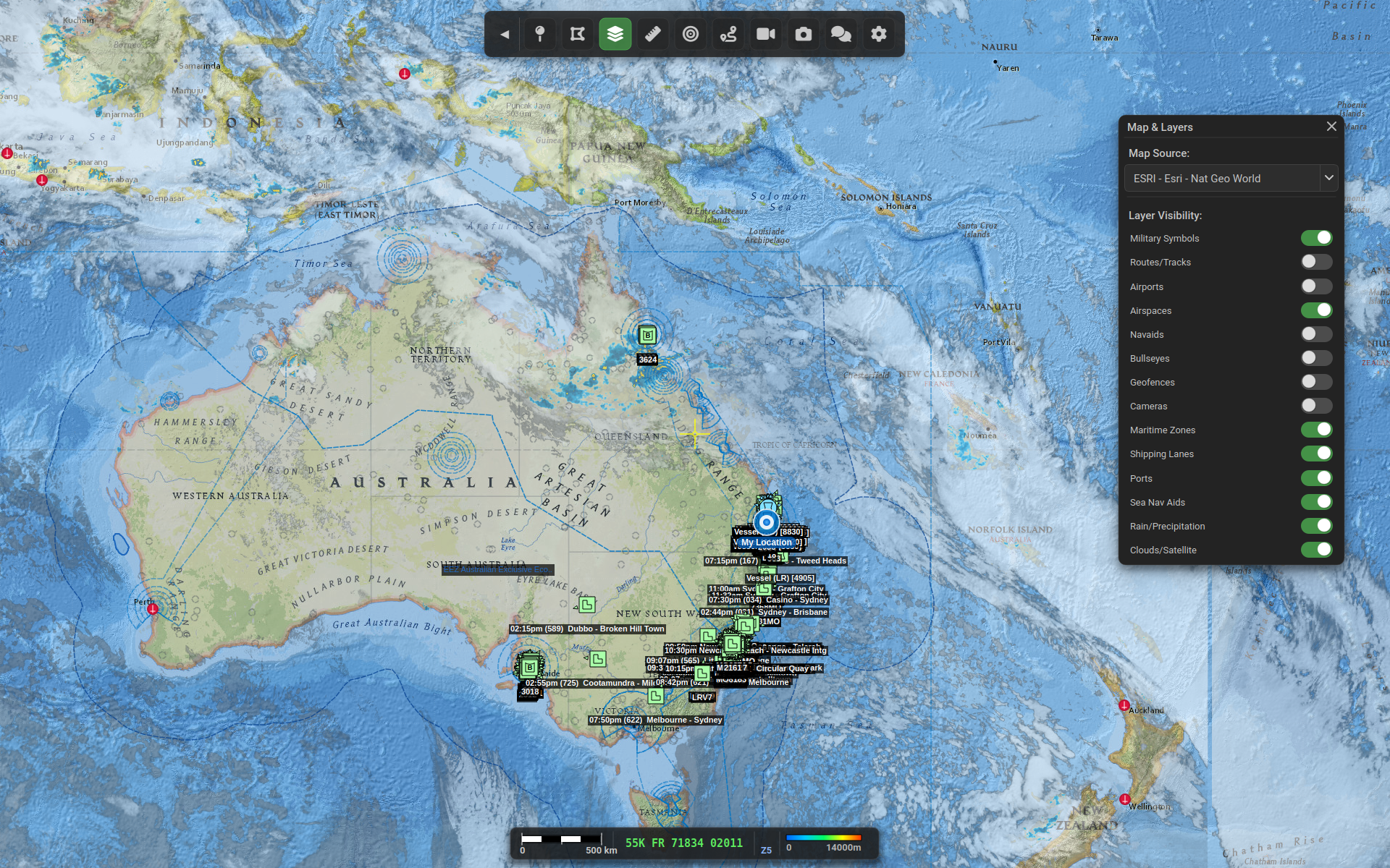
View realtime cloud (satalite images) and rain (RADAR) updates.
Data Agnostic Architecture
Our BMS is designed with a data agnostic philosophy, ensuring maximum flexibility and future-proofing for your operational requirements.
Connect Any Source, Any Format
- Multiple Data Feeds: Seamlessly ingest tactical data from radios, sensors, UAVs, and allied systems regardless of proprietary formats
- Protocol Flexibility: Native support for military standard protocols with extensible adapters for emerging data sources
- Real-Time Translation: Automatic normalisation of disparate data formats into a unified operational picture
- No Vendor Lock-In: Your data remains accessible and portable, never trapped in proprietary silos
Unified Common Operating Picture
Transform fragmented information into actionable intelligence. Our data agnostic approach means you see the complete battlefield—not just what one system wants to show you.
Supported Connectors & Data Sources
| Connector | Protocol | Transport | Description |
|---|---|---|---|
| SPX RADAR | Cambridge Pixel Binary | UDP Multicast | RADAR track reports from Cambridge Pixel systems |
| SAPIENT | BSI Flex 335 v2.0 | TCP Protobuf | Autonomous sensor integration (AI, RADAR) |
| CoT | Cursor on Target XML | TCP/Multicast | TAK ecosystem integration (ATAK, WinTAK) |
| NMEA | NMEA 0183 | Serial/TCP | GPS position data |
| ADS-B | OpenSky REST | HTTP/JSON | Real-time aircraft positions |
| AIS | AIS Messages | WebSocket | Maritime vessel tracking |
| GTFS | GTFS Realtime | HTTP/Protobuf | Public transit vehicle positions |
| JSON File | Custom JSON | File System | Static position data with live monitoring |
| LDM | Land Data Model v10 | DDS | GVA vehicle/unit positions |
![]()
![]()
Our BMS is part of a broader set of products enabled by the Genaric Vehicle Architecture (GVA) an open standard developed under the Land Open Systems Architecture (LOSA) an inititive by the UK MoD to increase interoperability between vendors.. Check out the documentation below.